A forest digital twin complements existing monitoring by providing a unified, harmonised framework.
- Existing forest monitoring systems already provide strong foundations, but they address specific scales, methods or national contexts.
- A digital twin of the Earth’s forests is not intended to replace national forest inventories; it is designed to complement them by offering broader context, harmonisation and scenario-based insights.
A forest digital twin integrates diverse datasets and predicts forest trajectories across multiple scenarios.
- A forest digital twin brings together currently scattered forest datasets and enables users to integrate their own data – optionally sharing it to support collaborative analysis.
- A unique feature of the forest digital twin is its ability to predict forest growth and development under different scenarios, such as varying climate, management and human pressure.

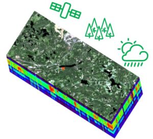
Input data
Satellite, forest and weather data
- optical multispectral satellite data: Sentinel-2 MSI products
- forest field data and national forestry databases
- weather data and different climate scenarios
- maximising the use of ready-made forest maps
- updating and enhancing existing maps with EO data
- new data (such as single tree detection)
- meteorological data provided by the Digital Twin of Climate Change Adaptation
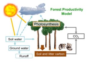
Process-based forest models
PRELES (light use efficiency model)
- inputs: solar radiation, temperature, VPD, precipitation, LAI
- outputs: GPP, ET, NEE, etc.
CROBAS (tree growth model)
- inputs: stand variables (height, diameter, density, species)
- outputs: stand variables, biomasses, litterfall, etc.
YASSO15 (soil carbon model)
- inputs: litterfall, woody debris
- outputs: soil carbon, heterotrophic respiration
3-PGmix (forest growth model)
- a new model (compared with the earlier Forest Precursor project) to be calibrated and included
Products and output data
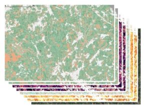
Yearly maps
- tree species
- tree height (m)
- stem diameter (cm)
- stem basal area (m2/ha)
- stem volume (m3/ha)
- annual stem volume increment (m3/ha/a)
- aboveground wood biomass (t/ha)
- belowground biomass (t/ha)
- carbon in woody biomass (tCO2eq/ha)
- gross primary production (tCO2eq/ha/a)
- net primary production (tCO2eq/ha/a)
- evapotranspiration (mm/a)
At very high resolution (10–20 m)
- to be used for downstream models and use cases